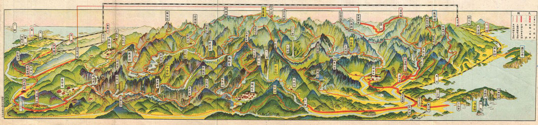
An extremely attractive 1939 panoramic view map of Kumgangsan or Diamond Mountain, North Korea. Kumgagsan is an important tourist destination, one of the few areas in North Korea that is open to foreign tourism and regularly visited by international travelers. The mountain is known for is dramatic views and stunning natural beauty. This uncommon type of map evolved out of traditional Japanese view-style cartography and began to appear in Japan, Taiwan, and Korea in the early 20th century. Generally speaking such maps coincided with the development of railroad lines throughout the once vast Dai Nippon Teikoku or Japanese Empire. It is a distinctive style full of artistic flourish that at the same time performs a practical function. This particular example is both relatively early and exceptionally beautiful. It was printed via a multi-color lithographic process with delicately shaded tones and a easily comprehensible intuitive design. Shows villages, famous sights, roadways, and rail lines.